
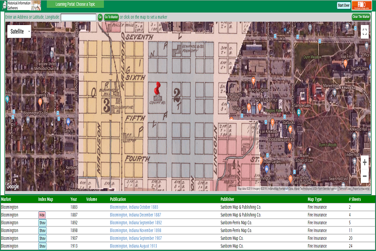
IU Libraries now provides free access to Fire Insurance Maps Online, or FIMo, for library users. With this resource users can access high-definition, georeferenced, color Fire Insurance Maps, Real Estate Atlases, Plat Books, and other historical maps showing building structures, building construction details, property ownership, property uses, and other useful information for the entire United States. This is a valuable tool for many types of research as these maps show building-level detail over a large time frame, and the map-based search makes it easy to determine which maps are available for a specific location or address.
Want to know more about Sanborn Maps? Check out the Union List of Sanborn Maps.