
The crises presented by the ongoing COVID-19 pandemic are constantly evolving and new information — be it economic, statistical, or health related — is available everyday. In and of itself, this ceaseless proliferation of information presents a challenge to the individual trying to make sense of it and understand what is happening locally, nationally, and globally. Effective interpretation and evaluation of information is a crucial skill necessary for tackling the current saturation of news, reports, data, press conferences, images and words.
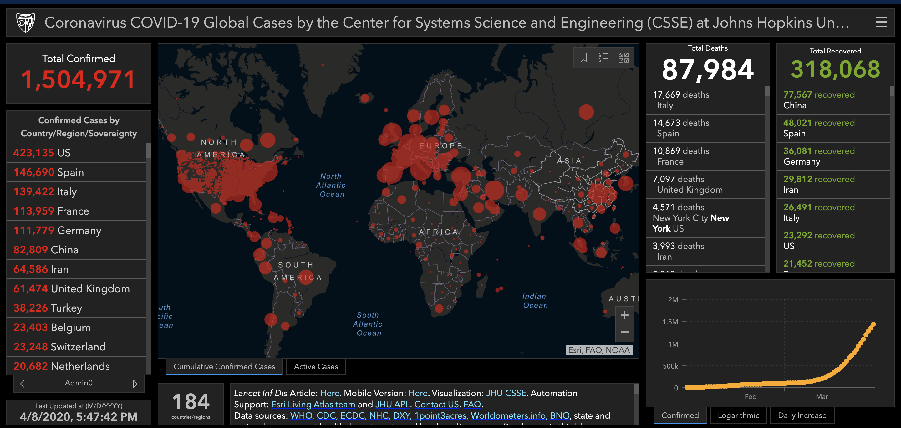
Maps represent a vital source of spatial information that — just like any one of the other aforementioned sources — must be interpreted and evaluated critically. Map and Spatial Data Librarian Theresa Quill and Visual Literacy and Resources Librarian Jackie Fleming have put together a LibGuide to equip you with the skills needed to competently analyze and understand the maps that you may encounter. This LibGuide will educate you on the topic of visual literacy, which can be briefly defined as "a set of abilities that enables an individual to effectively find, interpret, evaluate, use, and create images and visual media." Understanding visual literacy will help you to engage with maps critically, and thus ensure that you are effectively interpreting the information you are presented with. The LibGuide also contains a tips and tricks section specifically tailored for reading COVID-19 maps, a shortlist of credible COVID-19 maps, and a number of additional readings regarding COVID-19 maps.
This guide will continue to be updated, so be sure to refer back to it in the future for further topics on map-related literacy.